Take advantage of the ample parking available in Piazza Umberto I, then start from Chiesa Parrocchiale dei Santi Quirico e Paolo. From the church, take Via C. Battisti, but before you head up the hill, take a look to the right to see the tower behind the church. If you enter the courtyard, which is part of the Town Hall, you will find a playground. The curious building here is Torre del Cessi and is not medieval, but rather the work of local 19th-century architect Giovanni Battista Schellino, much like other buildings in the center of village.
- for who: children 6 and older. Non suited to strollers (small children should be in backpack carriers)
- when: spring, autumn, winter without much snow
Continue up along Via Battisti, which soon becomes a pedestrian-only zone for an enjoyable stroll through along the tree-lined street. At the end of the street, you will reach the main highway near the Church of the Immacolata. Be very careful as you continue up along brief section of highway past some old fountains until you reach an impressive cemetery, Cimitero Monumentale, another work by Schellino featuring wine-colored, neo-Gothic spires.
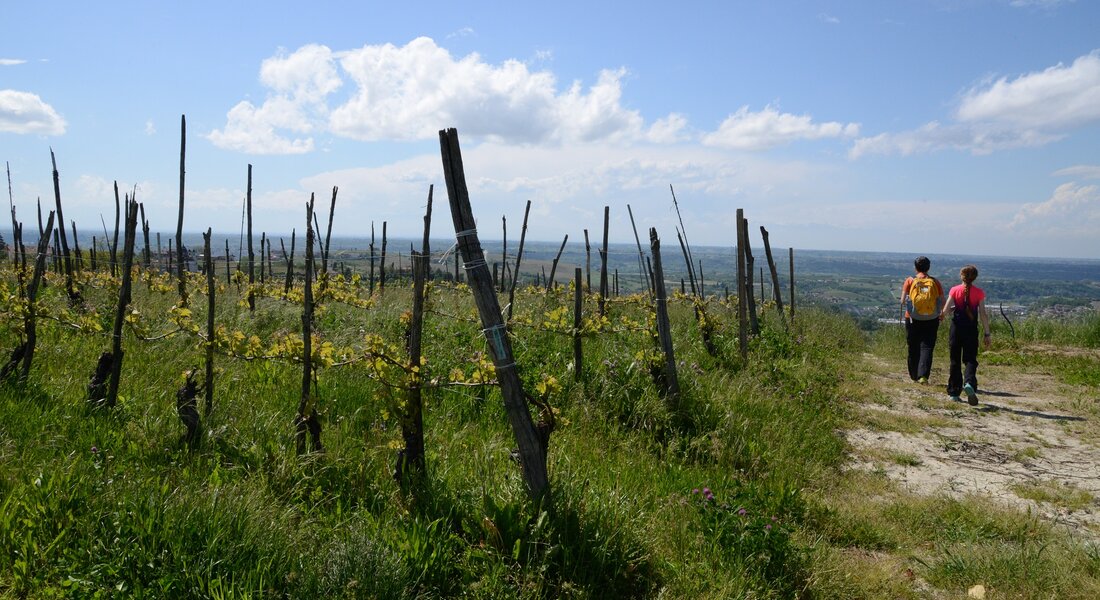
From the cemetery parking lot, take the cart track that starts near the shrine of the Rosary (sign: “Sentiero di Dogliani” burgundy itinerary, return trip). The trail is fairly steep and often muddy (best to avoid if raining) and crosses through a section of woods to an area of vineyards. Follow the grassy, slightly uphill trail in the direction of a farm-tourism business (agriturismo). Continue alongside the buildings and follow the dirt road until you reach a paved road. Turn left here.
CAUTION: What follows is a section of highway without a sidewalk.
Continue straight for about 300 meters (about 1,000 ft) past a number of shrines of the Rosary until you reach the Santuario Madonna delle Grazie. Automatic doors provide access for a visit of the sanctuary. The view here over the vineyards is spectacular. Continue along the highway for another 200 meters (655 ft), then, at the curve, turn off onto a paved, uphill road that will take you to the village of Pamparato. This gradually climbing, paved road crosses the village then turns into a dirt road. When you see a tall hedge, keep to the right to continue alongside the hedge and reach the highest point of this itinerary. The dirt road will then begin to descend gradually, with a beautiful view to your left. When you reach the paved road, continue downhill to the right. In front of you, you will see Dogliani with its cemetery, church and tower easily recognizable in the distance.
At an evident fork in the road, keep to the left. The dirt road will soon turn to gravel. Pass a shrine with a painting from 2016. Immediately after a building and a curve, keep to the left and head downhill. When you reach a small bridge in a curve, where you can see a red bell tower above you, take the trail on your right, which will take you up to a paved road after a brief climb. In front of you, you will see an archway. Go through the archway to come out near the Church of San Lorenzo. Pass in front of the church and take Via del Ritiro in the direction of the red clock tower, which you can now see, until you reach a vista point beneath the clock tower, where you will also find a horse chestnut tree and an enormous, colorful bench, a great place to sit and enjoy the view of the village and surrounding hills.
After this relaxing break, take the trail to the right that winds down towards the center of village and comes out into a small square. Take the narrow Vicolo Pizzorno in front of you, which will take you to Via Vittorio Emanuele II. Turn left here to go back to the starting point at the parish church.
Notes
You may notice that the burgundy-coloured arrows are always pointing in the opposite direction. We did this for logistical reasons, since it is an itinerary for cyclists, so if you can see them arriving from in front of you, you will have time to get out of the way. The section after the cemetery runs alongside a stream and is often muddy and slippery, so it’s best to do uphill to avoid falls. It also saves the arrival at Belvedere, with the colourful Big Bench and view of the village, for the end.
PLEASE NOTE: Responsibility for the maintenance and practicability of the various trails lies with the municipalities where the routes are located. The Tourist Board, therefore, cannot be held responsible for any inefficiencies, but is willingly available to collect your reports so that they can be forwarded to the authorities concerned.


