")
")

The Witch Micilina Path tells the stories of masche—the traditional witches of Piedmontese folklore—who, according to legend, inhabited the villages of the Rocche. This rugged landscape, full of steep cliffs and hidden dangers, provides a mysterious and evocative backdrop for the hike.

To enjoy the audio guide with an integrated GPX track, you can download the free Izi.Travel app on your smartphone and enable geolocation. This will trigger automatic narration at specific points of interest, sharing local stories and interesting facts. The audio guide is also available for preview via browser:
AUDIO GUIDE The Witch Micilina Path
The path winds through the main street of the village, passing the Baroque Confraternita di Sant'Agostino and the imposing 12th-century castle, once the fortress of the Lords of "Paucapalea."
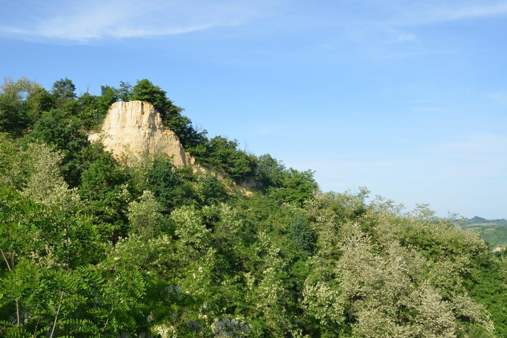
After the descent alongside the castle, continue on the paved road toward Località Saliceto. This stretch offers occasional views over the spectacular precipices of the Rocche. From here, you can see the hill known as "Bricchetto della Masca", where, according to legend, the witch Micilina was burned at the stake. Educational panels along the path tell her haunting story.
The walk continues for about 1 km through fields and hazelnut groves until you reach the first beautiful chestnut woods. Following the signs to the right, you will enter the "Area Asfodelo", a picnic spot dotted with poplars and oaks. From here, take the narrow, steep path leading toward the bottom of the ravine.
Surrounded by ferns, elderberries, wild hazelnuts, and oaks, continue until you reach a bright meadow clearing encircled by the forest. After a short descent, the path widens into a comfortable dirt road on the valley floor. Here, you are immersed in a lush forest of towering black locusts, oaks, and willows. You will walk between high canyon walls and a small stream that keeps the air cool even in summer. The dirt road continues past rural buildings to the small Church of San Giacomo, where the paved climb back to the village begins.
ITINERARY
- length: 4,5 km
- who it’s for: Children aged 6 and up. Not suitable for strollers (hiking baby carriers are recommended for toddlers).
- best time to visit: Spring, autumn, and winters with little snow.
SAFETY
The trail is marked with directional signs: please follow the path in the indicated direction. We recommend checking the weather forecast and visiting the Ecomuseo website or contacting their offices in advance to confirm the trail's current accessibility and conditions.
PLEASE NOTE: Responsibility for the maintenance and practicability of the various trails lies with the municipalities where the routes are located. The Tourist Board, therefore, cannot be held responsible for any inefficiencies, but is willingly available to collect your reports so that they can be forwarded to the authorities concerned.