Roero Bike Tour

RBT - Leg 3

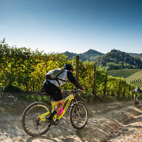
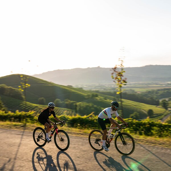
This leg of the itinerary takes you along the historic “Grande Sentiero del Roero”, which winds along the crest of the Rocche rock formations through the Silva Popularis, the last great forest of the Po Valley.


From Piazza Roma in Monteu Roero, follow the signs for the “Grande Sentiero del Roero” (S1). Cross the bridge over the gorge, then turn left in the direction of the town cemetery. Past the cemetery, the paved road continues along the flat past cultivated fields, greenhouses and hazelnut groves to Serramuana.

After an abrupt deviation to the left, you will be immersed in the woods as you descend back down towards Cascina Sacargena, just outside Montaldo Roero, the smallest of the hilltop villages in this area, but you will not actually enter the village unless you choose to make a slight detour. The trail runs along the edges of this municipality and its woods, vineyards, groves (of apricots in particular, so there is an apricot festival held here every year in June), its cylindrical, medieval tower rising up above it all. A symbol of the village, this tower rises up an impressive thirty metres (98 ft) and has a diameter of more than 8.5 metres (27 ft). It was commissioned by the Roero Family circa 1374 alongside the older castle, which previously belonged to the De Montaldo Family and was lost in the 1700s.

From Cascina Sacargena, the itinerary continues along highway SP 253 in the direction of Montaldo Roero. Near a wide crossroads, turn right onto highway SP 119 in the direction of Baldissero d’Alba. You will follow this highway for about two kilometres, so it will be best to keep to the right-hand edge of the road. The highway doesn’t see a lot of traffic, but better safe than sorry! It is also possible to cut the length of this highway section in half by following the S1 trail, which heads into the woods past the Rocche and joins up with highway SP 119 after about a kilometre. This flat highway will first pass by wheat fields and hazelnut groves and then run alongside old-growth chestnut groves, its majestic trees creating welcome shade for your journey.

Read More

Brought to the area by the ancient Romans, the chestnut tree was once quite common throughout Roero, but is now only found in significant numbers here on the Rocche. The peculiarity of these distinctive trees here is that they grow at an altitude of 300 metres (985 ft), which is much lower than in other areas dedicated to the cultivation of chestnuts. The local variety is known as the “castagna della Madonna” (chestnut of the Virgin Mary) because its harvest begins around the time of the Nativity of Mary (September 8th) and such an early harvest enables these chestnuts to be sold as the “first fruits” of the season. As the farmers here have always said, “It was the only crop that didn’t cost anything. All you had to do was go out and collect it, like manna from heaven.” Today, chestnut cultivation is being threatened by disease, but there are still vast areas of old-growth chestnut trees whose trunks can reach circumferences of greater than 5-6 metres (15-20 ft).

Returning to the itinerary, once you have reached Baldissero dAlba, turn left at the first houses and continue to the roundabout at the intersection with Via Roma. Looking up, you can see the silhouette of the neo-Gothic castle of the Colonna Family and its crenellated towers. Continue slightly uphill to the right along highway SP 119, then turn right after a few hundred metres near an information panel. From here, the route follows the S1 trail along a dirt road through cultivated fields and back into the woods. The views along this section are breathtaking as you pass numerous natural balconies overlooking gorges protected by wood fencing. The elevation gain here is significant and the edge of the trail— held together by the strong roots of oak trees and Scots pine clinging to the sand—overlooks the ravines in places.

Once you have left the woods, fields of isolated farmhouses will accompany you to an outlying residential area of the village of Sommariva Perno. Continue alongside a hotel complex, then turn left near Centro Sportivo del Roero onto highway SP 10, which will take you into town. At the intersection with Strada Sappelletto, leave the main road that would take you into the hilltop centre of the village (with its majestic castle, which was once the residence of Rosa Vercellana, the first Countess of Mirafiori and Fontanafredda and wife of Victor Emmanuel II, King of Italy), then turn right along a straight road, past homes with well-groomed yards.

This narrow, paved road continues through the countryside then turns to dirt and gravel after a few kilometres. Head back up the hillside and back into woods that stretch for many miles along the base of this damp valley alongside the Roero cliffs. These woods are a part of what locals refer to as the “fini superiori”, an important, protected forest that the ancient Romans referred to as silva popularis (from populus, poplar) and which features oak, poplar, Scots pine, and a rich undergrowth of periwinkle and asphodel.

As the trail leaves the woods, it becomes paved again and takes you to Saliceto/Cravioli in the village of Pocapaglia. At the roundabout, turn left in the direction of Pocapaglia, which you will reach after a long, straight stretch of road that runs along the rest area Asfodelo and descends gradually into the village. Past the small picnic area of San Sebastiano with its view over spectacular gorges on both sides, the road begins to climb up towards the Pocapaglia Castle, its walls draped in caper plants. Pass the castle’s magnificent outer gate with its warlike high-relief details, which are said to be the work of Jacopo Sansovino, and continue on into the central Piazza Principessa Maria Pia.

loghi

COVERED AREAS

Roero

GENERAL INFORMATION

Departure
Monteu Roero
Piazza Roma
12046
Italy
Arrival
Pocapaglia
Strada San Giusto
12040
Italy
Type of trail
Linear
Distanz
14 km
Difficulty
Intermediate
Estimated Time
4:30 hours

ACCESSIBILITY

Along the way:

E-bike charging stations along the trail
Picnic area along the trail
Fountains / water points along the trail
Bike Rental nearby

Point of interest along the way

Departure:
Monteu Roero
Piazza Roma
12046 Cuneo
Italy
Arrival:
Pocapaglia
Strada San Giusto
12040 Cuneo
Italy

    Suggested Itineraries

    The stages of this itinerary

    Back to the main itinerary
    • Stop 0
      RBT - Roero Bike Tour
      Borbore (Vezza d'Alba) -> Vernè (Castagnito)
      112.5km - Intermediate - 33:00h
    • Stop 1
      RBT - Leg 1
      Borbore (Vezza d'Alba) -> Montà
      11.8km - Intermediate - 3:20h
    • Stop 1
      Variant 1A
      RBT - Variant 1A
      Canale -> Rocca Tagliata (Canale)
      2.7km - Intermediate - 50m
    • Stop 2
      RBT - Leg 2
      Montà -> Monteu Roero
      8.6km - Intermediate - 3:00h
    • Stop 2
      Variant 2A
      RBT - Variant 2A
      Monteu Roero -> Battagli (Vezza d'Alba)
      7km - Intermediate - 2:00h
    • Stop 3
      RBT - Leg 3
      Monteu Roero -> Pocapaglia
      14km - Intermediate - 4:30h
    • Stop 3
      Variant 3A
      RBT - Variant 3A
      Saliceto (Pocapaglia) -> San Sebastiano (Pocapaglia)
      15.7km - Easy - 4:50h
    • Stop 4
      RBT - Leg 4
      Pocapaglia -> Monticello d'Alba
      15.8km - Intermediate - 5:00h
    • Stop 5
      RBT - Leg 5
      Monticello d'Alba -> Borbore (Vezza d'Alba)
      12.5km - Intermediate - 5:20h
    • Stop 6
      RBT - Leg 6
      Borbore (Vezza d'Alba) -> Govone
      20.3km - Easy - 6:00h
    • Stop 6
      Variant 6A
      RBT - Variant 6A
      Guarene -> Castagnito
      2.6km - Easy - 45m
    • Stop 7
      RBT - Leg 7
      Govone -> Vernè (Castagnito)
      22.3km - Intermediate - 6:30h
    • Stop 7
      Variant 7A
      RBT - Variant 7A
      Sotteri (Guarene) -> Guarene
      2km - Intermediate - 40m

      Suggested Itineraries

      • Barbaresco Barolo
        MTB Touring Routes
        Langhe
        Linear
        Partenza: Alba
        Arrivo: Treiso
        Demanding
        16 km
        1:55 hours
      • Trekking - Langhe
        Trekking
        Langhe
        Loop
        Partenza: Pietra dell'Appuntamento (Torresina)
        Arrivo: Pietra dell'Appuntamento (Torresina)
        Intermediate
        46.2 km
        17:00 hours
      • Roero Bike Tour
        MTB Touring Routes
        Roero
        Linear
        Partenza: Borbore (Vezza d'Alba)
        Arrivo: Govone
        Easy
        20.3 km
        6:00 hours
      • Bike - Monferrato
        Cycle Routes
        Monferrato
        Loop
        Partenza: Mombaruzzo
        Arrivo: Mombaruzzo
        Demanding
        50.4 km
        6:00 hours
      • Trekking - Langhe
        Trekking
        Langhe
        Loop
        Partenza: Prunetto
        Arrivo: Prunetto
        Intermediate
        16,2 km
        7:00 hours
      • Family - Trekking - Santo Stefano Roero
        Trekking
        Roero
        Adatto a Famiglie e bambini
        Loop
        Partenza: Santo Stefano Roero
        Arrivo: Santo Stefano Roero
        Easy
        5.5 km
        2:00 hours